Latitude and longitude: theoretical
background

|
|
Aviation Formulary
Great Circle Navigation Formulae, Distance between points, Course between
points, Latitude of point on GC, Lat/lon given radial and distance,
Intersection of two radials, Clairaut's formula, GC crossing parallel,
Intermediate points on a great circle, Cross track error and along track
distance, Points a known distance from a great circle, Distance to the
horizon |
|
Calculating
Distances Between Two Points ways to calculate the distance between two
points on the earth's surface, defined by their latitude and longitude |
|
Coordinate
Systems Overview description of basic coordinate systems, a description
of the shape of the Earth |
|
Geocoding geocoding is the process of assigning geographic coordinates
(e.g. latitude-longitude) to street addresses, as well as other points and
features |
|
Latitude and
longitude halfway between the North Pole and the South Pole is an imaginary line, the equator. The equator goes around
the middle of Earth like a belt. It divides our planet into the Northern Hemisphere and the Southern Hemisphere.
A number of imaginary lines are drawn around the globe parallel to the equator. These are called parallels of latitude. Another set of imaginary lines helps
us measure distance east and west. These are lines of longitude. Each line of longitude runs from the North Pole to the South Pole. These lines
are also called meridians |
| Latitude and
longitude latitude and longitude are spherical coordinates on the surface of the earth. Latitude is measured North or South of the Equator,
resulting in a range of -90 (S pole) to +90 (N pole) degrees. Longitude is measured East or West of Greenwich |
|
Latitude and
longitude |
|
latitude and longitude
Latitude and longitude are angles that uniquely define points on a sphere |
| Latitude
and longitude any location on Earth is described by two numbers--its
latitude and its longitude. If a pilot or a ship's captain
wants to specify position on a map, these are the "coordinates" they would
use |
| Latitude and
longitude defined, part of
Maptools MapTools provides GPS users with the tools and knowledge to fully utilize geographic coordinates. MapTools produces grids, corner
rulers, roamers, and rulers to assist with plotting or measuring positions on many different scales of maps |
|
latitude longitude lines
What are latitude and longitude lines absolute and relative locations |
| Latitude
and longitude printout |
|
Location,
distance, and direction on maps |
|
Navigation using latitude and longitude |
|
Natural Area Coding
System The Natural Area Coding System is a new system to standardize and
integrate geodetic datums, geographic coordinates, geographic area codes,
map grids, addresses and postal codes in the world |
| The
degree confluence project the degree confluence project contains
photographs of the intersections of integer latitude and longitude degree
lines, Geographic
center of the European Union |
|
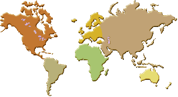
World latitude and longitude outline map cylindrical projection |
|
Horizontaal |
|
Latitude and longitude lookup and
calculators |
|
Addresses to/from
Latitude/Longitude/Altitude Converting Addresses to/from
Latitude/Longitude/Altitude in One Step |
|
Atlas query:
geographic location and time zone database a
reference source for private use by astrologers, to find longitude, latitude and time zone information |
| Convert latitude and longitude between decimal degrees and degrees, minutes, and seconds
This utility permits the user to convert latitude and longitude between
decimal degrees and degrees, minutes, and seconds |
|
Country code search |
|
Country Codes
Determining Two-Character Country Codes in One Step |
| Cross-reference list of geographic names latitude, longitude |
| Directory of cities and towns in world displays latitude, longitude, and local map |
| EarthTools
Find places, latitude/longitude, sunrise/sunset, elevation, local time and
time zones |
|
Gmaptools.googlepages.com/findLatLong.html find Latitude Longitude with
Google GMAP tools |
| Geographic
names (TGN) thesaurus of Geographic Names (TGN), is a structured vocabulary of geographic names,
Oosterzele: lat: 50° 57' N long: 003° 48' E, Balegem: lat: 50° 55'
17" N long: 03° 47' 19" E, Brussels: Latitude= 50.85 N; Longitude: 4.37 E, a tip |
| GEOnet Names
Server (GNS) worldwide excluding the United States and Antarctica, Use the U.S. Gazetteer
for the United States or Geocode.com |
| How far is it? calculates the distance between two places in the world |
|
Language code search |
|
Latitude/Longitude
Converter important information about a variety of formats that are
commonly used for latitude and longitude coordinates, how to convert between
them, and how to use the coordinates |
| Latitude and
longitude of world cities |
|
Latitude/Longitude
Distance Calculation determine the distance between two points on the
earth given their latitudes and longitudes |
|
Latitude, longitude
format conversion Convert Decimal Degrees to Degrees, Minutes, and Seconds,
Convert Degrees, Minutes, and Seconds to Decimal Degrees |
|
Latitude - longitude place finder
Converting Addresses to Latitude/Longitude in One Step |
|
Latitude/longitude points Calculate distance, bearing and more between
Latitude/Longitude point, Convert between degrees-minutes-seconds & decimal
degrees |
| Latitude and longitude search engine
(Astro.com), a tip |
| Latitude and longitude: surface distance between points of latitude and longitude Javascript program to calculate great circle distance using latitude and longitude points on the
earth |
| Multimap
offers the coordinate of the latitude and longitude in deg/min/sec, a tip |
|
Satellite Imagery |
|
Solar Calculator
Find Sunrise, Sunset, Solar Noon and Solar Position for Any Place on Earth |
| Surface
distance calculator calculate distance between places |
|
View Above Earth
To view the Earth from space, looking down on a given point, enter the
latitude, longitude, and altitude of the viewing point |
|
World Map
flash earth, Flash Earth is an experimental application for viewing
satellite and aerial imagery of the Earth from multiple mapping websites
inside a single Flash-based interface. It is not designed to be a
fully-fledged mapping application but more for enjoying and exploring images
of our planet, Latitude, Longitude, a tip |
|
Horizontaal |
|
|
Home
|
Site Map
|
Email: support[at]karadimov.info
Last updated on:
2011-01-22
|
Copyright © 2011-2021 Educypedia.
http://educypedia.karadimov.info
|
| |