World maps  related topic: History maps,
World war II maps
related topic: History maps,
World war II maps |
|
Altimetry
atlas mean sea surface and gravity anomaly maps of the oceans |
|
ATLAS OF
POPULATION AND ENVIRONMENT the alas of population and environment
is an important analysis of the relationships between human population and
the environment |
|
Atmospheric Water Vapor |
|
Biodiversity |
|
Biodiversity: World atlas of
biodiversity
the biosphere, the diversity of organisms, biodiversity through time, humans and biodiversity,
terrestrial biodiversity, marine biodiversity, freshwater biodiversity, responding to change |
|
Biomes of the
World |
|
Biosphere: Atlas of the biosphere |
|
Cities: Biggest
cities in the World |
|
Climate Change
Global Distribution of Vulnerability to Climate Change |
|
Climate maps,
World climates
map pdf file |
|
Current floods world wide <-- ALERT |
|
Current storms world wide <-- ALERT |
| Daylightmap |
|
Daylight saving time (also
called DST, or Summer Time) |
|
Earth at Night Streetlights are the source of most of the light seen in
this image, but petroleum fires also contribute |
|
Earth at Night |
|
Earthquake: Current world earthquake activity Latest Earthquakes
in the World - Past 7 days, <-- ALERT |
|
Earthquake
maps these maps are generated automatically every 6 hours |
|
Earthquakes
- Worldmaps Interactive maps of earthquakes. Last earthquakes worldwide
for the last 48 hours. World, Euro-Med, North America, South America, Africa
& Indian Ocean, Pacific, World Seismicity Maps |
|
Earthquakes |
|
Earthquakes: Understanding
earthquakes view a rotating globe showing earthquake locations |
|
Earth surface
topography map shows 2 minute bathymetric/topographic colour relief
images of the Earth's surface |
| Earthview
showing the day and night regions at this moment, Earth
and moon viewer |
|
Education
maps Global, Continent, and National Maps |
|
Electricity
Consumption - worldmap Electricity Consumption - worldmap |
|
Energy: Global energy population CO2 water swf file |
|
Energy: International Energy Agency - World maps of: Energy Production, Net
Imports, Total Primary Energy Supply, Electricity Consumption, Population,
Gross Domestic Product, GDP (PPP), TPES / Population, TPES / GDP, TPES/ GDP
(PPP), Elec. Cons. / Population, CO2 Emissions, CO2 / TPES, CO2 /
Population, CO2 / GDP, CO2 / GDP (PPP), Map Energy Indicators, World -
Energy Production |
|
Energy
Production 2006 map Energy Production: Total production of primary
energy, i.e. hard coal, lignite, peat, crude oil, NGLs, natural gas,
combustible renewables & waste, nuclear, hydro, geothermal, solar and the
heat from heat pumps that is extracted from the ambient environment |
|
Environnement: United Nations environment
programme maps, environnement, pollution, rain, energy, economy, a
tip |
|
Facebook map
of the world |
|
Fiber network optical Fiber network |
|
Fiber network
optical Fiber network |
|
Flags and maps of the world |
|
Flood map
Earth observatory: real time flood map
<-- ALERT |
|
Forest Interactive Maps |
|
Forests
in the world Forests in the world, Global Distribution of Current
Forests |
|
Forests
in the world |
|
Forests
in the world |
|
Francophone World Map |
|
Geothermal Electricity
Production Worldwide Breakdown of Geothermal Electricity Production |
|
Global Heat Flow Database
The Global Heat Flow Database of The International Heat Flow Commission |
|
Globalis -
an interactive world map this map shows the impact from the human
society on the ecosystems of the world. Our influence from construction,
cities and roads decrease the natural value and the biodiversity where we
influence and put stress on the environment |
|
Globe
gallery |
|
Grasslands of the world
map, pdf file |
|
Grey line map
a band around the Earth that separates daylight from darkness, map will automatically refresh every 5 minutes |
|
Human Impacts on Marine
Ecosystems |
|
Inequality: Atlas of global
inequality explores some aspects of inequality using online, downloadable maps and graphics |
|
Islands of the
World |
|
Landmine Problem in the World |
|
Life expectancy world map |
|
Magnetic
peculiarities - or anomalies The first global map of magnetic
peculiarities - or anomalies - on Earth has been assembled by an
international team of researchers. Magnetic anomalies are caused by
differences in the magnetisation of the rocks in the Earth's crust |
|
Marine Geophysical Data Map |
|
Marine
Mammals Atlas |
|
Meteo: Aviation
Weather Center (AWC) International Satellite Imagery |
|
Meteosat
latest images a tip |
|
NASA
- Visible Earth world atlas from space, jpg file |
|
Natural
disasters disaster response information on current natural disasters
and archival material dating back to 1981, listed chronologically |
|
Night sky in the World
light pollution, satellite monitoring of the
artificial night sky brightness and the stellar visibility |
|
Nuclear
power by country |
|
Nuclear Power Plants Nuclear Power Plants of the world,
pdf file |
|
Nuclear Power Reactors
Maps of Nuclear Power Reactors |
|
Nuclear power stations |
|
Oil production Oil production in the world |
|
Orthographic projections Orthographic projection is a type of graphical
and parallel projection, where the view direction is orthogonal to the
projection plane, resulting in every plane of the scene appearing in affine
transformation on the viewing surface |
|
Pandemic
(H1N1) 2009 |
|
Photovoltaic Geographical Information System (PVGIS) Geographical
Assessment of Solar Resource and Performance of Photovoltaic Technology |
|
Physical
Map of the World Physical Map of the World,
jpg file |
|
Physical
Map of the World |
|
Plate Boundaries World Plate Boundaries |
|
Plate tectonics map World Plate tectonics map, gif file |
|
Political World Map
pdf file |
|
Political World Map
gif file |
|
Political World Map
Political World Map,
jpg file |
|
Political World Map
Political World Map,
jpg file |
|
Political World Map
Colorful Political World map |
|
Population density by country |
|
Power Plugs and Sockets
all over the World |
|
Religions Modern Distribution of World Religions |
|
Religions
pdf file |
|
Renewable Energy Resource Maps Here you will find renewable energy resource
maps (global/ continent wide/ country) with definitions, information, Global
Renewable Energy Maps, Bioenergy, Geothermal, Hydropower, Ocean, Solar, Wind |
|
River Discharge Database |
|
Satellite
maps |
|
SATELLITE TRACKING Real time
satellite tracking web application. Over 15000 satellites real time tracked.
Other thousands of objects |
|
Seagrasses World Atlas of Seagrasses |
|
Seismic
maps recent seismic events are displayed on this inter active map. Learn about the dynamics of recent earthquakes and the stations that record the data
<-- ALERT |
|
Seismicity Maps World Seismicity Maps |
|
Solar Eclipse Atlases Solar Eclipse Atlas Map: 1981-2000, Solar Eclipse
Atlas Map: 2001-2020 |
|
Solar Eclipse
Maps |
|
Solar Eclipse
Maps World Map of Total Solar Eclipses |
|
Solar radiation The maps show the geographical distribution of the solar
radiation incident on the earth's surface each year, kWh/m2 |
|
Submarine cables by Telegeography |
|
Submarine cables by Guardian |
|
Submarine cables interactive |
|
Sun path chart
program This program creates sun path charts in Cartesian coordinates for:
(1) "typical" dates of each month (i.e.; days receiving about the mean
amount of solar radiation for a day in the given month); (2) dates spaced
about 30 days apart, from one solstice to the next; or (3) a single date you
specify. You can select whether hours are plotted using local standard time
or solar time |
|
Surface of the Earth
jpg file |
|
Tectonic activity map of the earth
jpg file |
|
Tectonic Plates of
the World Tectonic Plates of the Earth |
|
TimeTicker
Timeticker - The exact time of the world. A full featured Multimedia-Site
created with Flash |
|
Timezone: World time zone map
printable time zone map |
|
Timezone World Time Zones, gif file |
|
Timezone
Standard World Time Zones |
|
Time Zone World Time Zone, gif file |
|
Time Zone Map
Time Zone Map showing
current time zones from across the world |
|
Timezones
of the world Timezones of the world, pdf file |
|
Travelmaps |
|
UNESCO MAB
biosphere reserve directory interactive map information on individual
biosphere reserves |
|
United Nations geoscheme |
|
Views of the world |
|
Volcanoes of the world
find volcanoes,
map |
|
Water
resources and fresh water maps |
|
Water resources
eAtlas watersheds of the world, provides maps of land cover, population
density and biodiversity for 154 basins and sub-basins around the world |
|
Watersheds of the World provides maps of land cover, population
density and biodiversity for 154 basins and sub-basins around the world |
|
Wave
power distribution Global wave power distribution in kW/m of crest
length, scroll down, page 9, pdf file |
|
Wind Atlases of the World
Windmaps |
|
Windreports
worldwide real time wind & weather reports |
|
World
Atlas Solar Eclipses The following atlas of world maps show the path of
every total, annular and hybrid solar eclipse visible from Earth during the
five millennium period -1999 to +3000 (2000 BCE to 3000 CE). The maps are
broken down into 20 year intervals |
| World
flag database illustrated guide to the flags of the world |
|
World heritage sites map |
|
Worldbank |
|
World Climate Regions |
|
World Map
flash earth, Flash Earth is an experimental application for viewing
satellite and aerial imagery of the Earth from multiple mapping websites
inside a single Flash-based interface. It is not designed to be a
fully-fledged mapping application but more for enjoying and exploring images
of our planet, Latitude, Longitude, a tip |
|
World map
Colorful World map, pdf file |
|
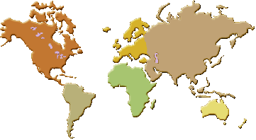
World map
Color-coded regions of the world based on the seven commonly-recognised
continents |
|
World map world maps |
|
World map
Map of Earth showing lines of latitude (horizontally) and longitude
(vertically) |
|
World map |
|
World map
map of the world in the Russian language |
|
World Ocean Atlas |
|
World Seismicity Maps earthquakes, seismicity, seismic, tremors, world, moment tensor,
moment, magnitude, magnitude scale, aftershock, epicenter, richter,
mercalli, seismogram, seismograph, seismologist, seismology, geophysics,
geologist, tsnuamis. USGS Earthquake Hazards Program provides earthquake
information for current and past earthquakes, hazards and preparedness
information, and education resources for teachers and students |
|
World sunlight |
|
World Weather Map |
|
World Wide Panorama Map |
|
Horizontaal |
|
|
Home
|
Site Map
|
Email: support[at]karadimov.info
Last updated on:
2011-01-03
|
Copyright © 2011-2021 Educypedia.
http://educypedia.karadimov.info
|
| |